Layer Control Information
Map layers added to the map will appear in this window. The ordering of the layers on map can be controlled by clicking the up and down arrows next to each layer (when more than one layer is added). Layers can be temporarily turned on and off by clicking the appropriate button underneath the layer name.
Click the Remove button to remove the layer from the map. The transparency/opacity of each layer can be controlled with the slider below the layer name with 0% being fully transparent and 100% being fully opaque.
Scenario Assessment of LU Change Potential
This tool demonstrates how geospatially combining driving factors of land use can be used to preliminarily identify opportunities for forest and ecological assessment, specifically in Highlands and Pinelands regions of New Jersey.
ArcGIS and publicly available data, a raster weighted overlay suitability modeling approach was used to combine several biophysical and socioeconomic factors to identify potential spots for land use conversion. This approach provides a starting point for stakeholders, forest and land managers involvement regarding municipality, county or watershed specific conditions and forest management goals. Each overlay layer was valued by the attributes within and based on a common scale (0-low suitability to 9-high suitability). Each driving factor is given an influence percentage with relative importance according to the literature review (available on data sources tab). Classification on suitability is based upon a natural breaks statistical classification (High, Moderate, Low).
Agricultural Land Conversion Priority
Table 1. Spatial data rankings and weighted overlay analysis for agricultural land conversion priority.
Agricultural land conversion priority represents a scenario where higher percent influence is given to agricultural non-preserved farmland areas for future residential land use selection.
| Parameters | Ranks | Suitability |
|---|---|---|
| Agriculture | 9 | High |
| Barren | 7 | High |
| Forest | 3 | Moderate |
| Urban/Built-up Area | 0 | Low |
| Water | 0 | Low |
| Wetlands | 0 | Low |
| Preserved | 0 | Low |
| Parameters | Ranks | Suitability |
|---|---|---|
| Up to 1 mile | 9 | High |
| Up to 4 miles | 7 | High |
| Up to 10 miles | 1 | Low |
| Parameters | Ranks | Suitability |
|---|---|---|
| Up to 1 mile | 9 | High |
| Up to 4 miles | 7 | High |
| Up to 10 miles | 2 | Low |
| Up to 50 miles | 1 | Low |
| Parameters | Ranks | Suitability |
|---|---|---|
| Up to 1 mile | 9 | High |
| Up to 4 miles | 7 | High |
| Up to 10 miles | 1 | Low |
| Parameters | Ranks | Suitability |
|---|---|---|
| 0-16 | 9 | High |
| 17-36 | 5 | High |
| 37-63 | 3 | Moderate |
| 64-103 | 2 | Low |
| 104-308 | 1 | Low |
Agriculture Priority
Table 2. Spatial data rankings and weighted overlay analysis for agricultural priority.
Agriculture priority represents a scenario where high agricultural priority areas in non-preserved farmland are restricted from future residential land use selection.
| Parameters | Ranks | Suitability |
|---|---|---|
| Agriculture | 9 | High |
| Barren | 7 | High |
| Forest | 3 | Moderate |
| Urban/Built-up Area | 0 | Low |
| Water | 0 | Low |
| Wetlands | 0 | Low |
| Preserved | 0 | Low |
| Parameters | Ranks | Suitability |
|---|---|---|
| Up to 1 mile | 9 | High |
| Up to 4 miles | 7 | High |
| Up to 10 miles | 1 | Low |
| Parameters | Ranks | Suitability |
|---|---|---|
| Up to 1 mile | 9 | High |
| Up to 4 miles | 7 | High |
| Up to 10 miles | 2 | Low |
| Up to 50 miles | 1 | Low |
| Parameters | Ranks | Suitability |
|---|---|---|
| Up to 1 mile | 9 | High |
| Up to 4 miles | 7 | High |
| Up to 10 miles | 1 | Low |
Medium Agricultural Focused Priority
Table 12. Spatial data rankings and weighted overlay analysis for medium agricultural focused priority
| Parameters | Ranks | Suitability |
|---|---|---|
| Agriculture | 9 | High |
| Barren | 7 | High |
| Forest | 3 | Moderate |
| Urban/Built-up Area | 0 | Low |
| Water | 0 | Low |
| Wetlands | 0 | Low |
| Preserved | 0 | Low |
| Parameters | Ranks | Suitability |
|---|---|---|
| Up to 1 mile | 9 | High |
| Up to 4 miles | 7 | High |
| Up to 10 miles | 1 | Low |
| Parameters | Ranks | Suitability |
|---|---|---|
| Up to 1 mile | 9 | High |
| Up to 4 miles | 7 | High |
| Up to 10 miles | 2 | Low |
| Up to 50 miles | 1 | Low |
| Parameters | Ranks | Suitability |
|---|---|---|
| Up to 1 mile | 9 | High |
| Up to 4 miles | 7 | High |
| Up to 10 miles | 1 | Low |
| Parameters | Ranks | Suitability |
|---|---|---|
| Sewer service area | 9 | High |
Medium Agricultural Focused Priority
Table 7. Spatial data rankings and weighted overlay analysis for medium agricultural focused priority.
| Parameters | Ranks | Suitability |
|---|---|---|
| Agriculture | 9 | High |
| Barren | 7 | High |
| Forest | 3 | Moderate |
| Urban/Built-up Area | 0 | Low |
| Water | 0 | Low |
| Wetlands | 0 | Low |
| Preserved | 0 | Low |
| Parameters | Ranks | Suitability |
|---|---|---|
| Up to 1 mile | 9 | High |
| Up to 4 miles | 7 | High |
| Up to 10 miles | 1 | Low |
| Parameters | Ranks | Suitability |
|---|---|---|
| Up to 1 mile | 9 | High |
| Up to 4 miles | 7 | High |
| Up to 10 miles | 2 | Low |
| Up to 50 miles | 1 | Low |
| Parameters | Ranks | Suitability |
|---|---|---|
| Up to 1 mile | 9 | High |
| Up to 4 miles | 7 | High |
| Up to 10 miles | 1 | Low |
| Parameters | Ranks | Suitability |
|---|---|---|
| 0-16 | 9 | High |
| 17-36 | 5 | High |
| 37-63 | 3 | Moderate |
| 64-103 | 2 | Low |
| 104-308 | 1 | Low |
| Parameters | Ranks | Suitability |
|---|---|---|
| Sewer service area | 9 | High |
High Agricultural Focused Priority
Table 13. Spatial data rankings and weighted overlay analysis for high agricultural focused priority
| Parameters | Ranks | Suitability |
|---|---|---|
| Agriculture | 9 | High |
| Barren | 7 | High |
| Forest | 3 | Moderate |
| Urban/Built-up Area | 0 | Low |
| Water | 0 | Low |
| Wetlands | 0 | Low |
| Preserved | 0 | Low |
| Parameters | Ranks | Suitability |
|---|---|---|
| Up to 1 mile | 9 | High |
| Up to 4 miles | 7 | High |
| Up to 10 miles | 1 | Low |
| Parameters | Ranks | Suitability |
|---|---|---|
| Up to 1 mile | 9 | High |
| Up to 4 miles | 7 | High |
| Up to 10 miles | 2 | Low |
| Up to 50 miles | 1 | Low |
| Parameters | Ranks | Suitability |
|---|---|---|
| Up to 1 mile | 9 | High |
| Up to 4 miles | 7 | High |
| Up to 10 miles | 1 | Low |
| Parameters | Ranks | Suitability |
|---|---|---|
| Sewer service area | 9 | High |
High Agricultural Focused Priority
Table 8. Spatial data rankings and weighted overlay analysis for high agricultural focused priority.
| Parameters | Ranks | Suitability |
|---|---|---|
| Agriculture | 9 | High |
| Barren | 7 | High |
| Forest | 3 | Moderate |
| Urban/Built-up Area | 0 | Low |
| Water | 0 | Low |
| Wetlands | 0 | Low |
| Preserved | 0 | Low |
| Parameters | Ranks | Suitability |
|---|---|---|
| Up to 1 mile | 9 | High |
| Up to 4 miles | 7 | High |
| Up to 10 miles | 1 | Low |
| Parameters | Ranks | Suitability |
|---|---|---|
| Up to 1 mile | 9 | High |
| Up to 4 miles | 7 | High |
| Up to 10 miles | 2 | Low |
| Up to 50 miles | 1 | Low |
| Parameters | Ranks | Suitability |
|---|---|---|
| Up to 1 mile | 9 | High |
| Up to 4 miles | 7 | High |
| Up to 10 miles | 1 | Low |
| Parameters | Ranks | Suitability |
|---|---|---|
| 0-16 | 9 | High |
| 17-36 | 5 | High |
| 37-63 | 3 | Moderate |
| 64-103 | 2 | Low |
| 104-308 | 1 | Low |
| Parameters | Ranks | Suitability |
|---|---|---|
| Sewer service area | 9 | High |
Amenity Focued Priority
Table 3. Spatial data rankings and weighted overlay analysis for amenity focused priority.
Amenity focused priority represents a scenario where higher percent influence is given to areas closer to natural scenic areas, and natural amenities for future residential land use selection.
| Parameters | Ranks | Suitability |
|---|---|---|
| Agriculture | 9 | High |
| Barren | 5 | Moderate |
| Forest | 3 | Moderate |
| Urban/Built-up Area | 0 | Low |
| Water | 0 | Low |
| Wetlands | 0 | Low |
| Preserved | 0 | Low |
| Parameters | Ranks | Suitability |
|---|---|---|
| Up to 1 mile | 9 | High |
| Up to 4 miles | 7 | High |
| Up to 10 miles | 5 | Moderate |
| Parameters | Ranks | Suitability |
|---|---|---|
| Up to 1 mile | 9 | High |
| Up to 4 miles | 7 | High |
| Up to 10 miles | 2 | Low |
| Up to 50 miles | 1 | Low |
| Parameters | Ranks | Suitability |
|---|---|---|
| Up to 1 mile | 9 | High |
| Up to 4 miles | 7 | High |
| Up to 10 miles | 1 | Low |
| Parameters | Ranks | Suitability |
|---|---|---|
| Up to 1 mile | 9 | High |
| Up to 4 miles | 7 | High |
Conservation Priority Areas
Table 3. Spatial data rankings and weighted overlay analysis for conservation priority
Conservation priority areas represents a scenario where high conversation priority areas are restricted from future residential land selection.
| Parameters | Ranks | Suitability |
|---|---|---|
| Agriculture | 9 | High |
| Barren | 7 | High |
| Forest | 3 | Moderate |
| Urban/Built-up Area | 0 | Low |
| Water | 0 | Low |
| Wetlands | 0 | Low |
| Preserved | 0 | Low |
| Parameters | Ranks | Suitability |
|---|---|---|
| Up to 1 mile | 9 | High |
| Up to 4 miles | 7 | High |
| Up to 10 miles | 1 | Low |
| Parameters | Ranks | Suitability |
|---|---|---|
| Up to 1 mile | 9 | High |
| Up to 4 miles | 7 | High |
| Up to 10 miles | 2 | Low |
| Up to 50 miles | 1 | Low |
| Parameters | Ranks | Suitability |
|---|---|---|
| Up to 1 mile | 9 | High |
| Up to 4 miles | 7 | High |
| Up to 10 miles | 1 | Low |
Equal Priority of Factors
Table 4. Spatial data rankings and weighted overlay analysis for equal priority.
Given equal priority to all driving factors for future residential land use selection.
| Parameters | Ranks | Suitability |
|---|---|---|
| Agriculture | 9 | High |
| Barren | 7 | High |
| Forest | 3 | Moderate |
| Urban/Built-up Area | 0 | Low |
| Water | 0 | Low |
| Wetlands | 0 | Low |
| Preserved | 0 | Low |
| Parameters | Ranks | Suitability |
|---|---|---|
| Up to 1 mile | 9 | High |
| Up to 4 miles | 7 | High |
| Up to 10 miles | 1 | Low |
| Parameters | Ranks | Suitability |
|---|---|---|
| Up to 1 mile | 9 | High |
| Up to 4 miles | 7 | High |
| Up to 10 miles | 2 | Low |
| Up to 50 miles | 1 | Low |
| Parameters | Ranks | Suitability |
|---|---|---|
| Up to 1 mile | 9 | High |
| Up to 4 miles | 7 | High |
| Up to 10 miles | 1 | Low |
| Parameters | Ranks | Suitability |
|---|---|---|
| 0-16 | 9 | High |
| 17-36 | 5 | High |
| 37-63 | 3 | Moderate |
| 64-103 | 2 | Low |
| 104-308 | 1 | Low |
Equal Priority of Infrastructure Factors
Table 5. Spatial data rankings and weighted overlay analysis for equal priority of each infrastructure focused factors.
| Parameters | Ranks | Suitability |
|---|---|---|
| Agriculture | 9 | High |
| Barren | 7 | High |
| Forest | 3 | Moderate |
| Urban/Built-up Area | 0 | Low |
| Water | 0 | Low |
| Wetlands | 0 | Low |
| Preserved | 0 | Low |
| Parameters | Ranks | Suitability |
|---|---|---|
| Up to 1 mile | 9 | High |
| Up to 4 miles | 7 | High |
| Up to 10 miles | 1 | Low |
| Parameters | Ranks | Suitability |
|---|---|---|
| Up to 1 mile | 9 | High |
| Up to 4 miles | 7 | High |
| Up to 10 miles | 2 | Low |
| Up to 50 miles | 1 | Low |
| Parameters | Ranks | Suitability |
|---|---|---|
| Up to 1 mile | 9 | High |
| Up to 4 miles | 7 | High |
| Up to 10 miles | 1 | Low |
| Parameters | Ranks | Suitability |
|---|---|---|
| 0-16 | 9 | High |
| 17-36 | 5 | High |
| 37-63 | 3 | Moderate |
| 64-103 | 2 | Low |
| 104-308 | 1 | Low |
| Parameters | Ranks | Suitability |
|---|---|---|
| Sewer service area | 9 | High |
Equal Priority of Factors
Table 10. Spatial data rankings and weighted overlay analysis for equal priority.
Given equal priority to all driving factors for future residential land use selection.
| Parameters | Ranks | Suitability |
|---|---|---|
| Agriculture | 9 | High |
| Barren | 7 | High |
| Forest | 3 | Moderate |
| Urban/Built-up Area | 0 | Low |
| Water | 0 | Low |
| Wetlands | 0 | Low |
| Preserved | 0 | Low |
| Parameters | Ranks | Suitability |
|---|---|---|
| Up to 1 mile | 9 | High |
| Up to 4 miles | 7 | High |
| Up to 10 miles | 1 | Low |
| Parameters | Ranks | Suitability |
|---|---|---|
| Up to 1 mile | 9 | High |
| Up to 4 miles | 7 | High |
| Up to 10 miles | 2 | Low |
| Up to 50 miles | 1 | Low |
| Parameters | Ranks | Suitability |
|---|---|---|
| Up to 1 mile | 9 | High |
| Up to 4 miles | 7 | High |
| Up to 10 miles | 1 | Low |
| Parameters | Ranks | Suitability |
|---|---|---|
| Sewer service area | 9 | High |
Infrastructure Focused Priority
Table 6. Spatial data rankings and weighted overlay analysis for Infrastructure Focused Priority.
| Parameters | Ranks | Suitability |
|---|---|---|
| Agriculture | 9 | High |
| Barren | 7 | High |
| Forest | 3 | Moderate |
| Urban/Built-up Area | 0 | Low |
| Water | 0 | Low |
| Wetlands | 0 | Low |
| Preserved | 0 | Low |
| Parameters | Ranks | Suitability |
|---|---|---|
| Up to 1 mile | 9 | High |
| Up to 4 miles | 7 | High |
| Up to 10 miles | 1 | Low |
| Parameters | Ranks | Suitability |
|---|---|---|
| Up to 1 mile | 9 | High |
| Up to 4 miles | 7 | High |
| Up to 10 miles | 2 | Low |
| Up to 50 miles | 1 | Low |
| Parameters | Ranks | Suitability |
|---|---|---|
| Up to 1 mile | 9 | High |
| Up to 4 miles | 7 | High |
| Up to 10 miles | 1 | Low |
| Parameters | Ranks | Suitability |
|---|---|---|
| 0-16 | 9 | High |
| 17-36 | 5 | High |
| 37-63 | 3 | Moderate |
| 64-103 | 2 | Low |
| 104-308 | 1 | Low |
| Parameters | Ranks | Suitability |
|---|---|---|
| Sewer service area | 9 | High |
Infrastructure Focused Priority
Table 11. Spatial data rankings and weighted overlay analysis for equal priority of each infrastructure focused factors
Infrastructure focused priority has several infrastructure focused sub-scenarios.
| Parameters | Ranks | Suitability |
|---|---|---|
| Agriculture | 9 | High |
| Barren | 7 | High |
| Forest | 3 | Moderate |
| Urban/Built-up Area | 0 | Low |
| Water | 0 | Low |
| Wetlands | 0 | Low |
| Preserved | 0 | Low |
| Parameters | Ranks | Suitability |
|---|---|---|
| Up to 1 mile | 9 | High |
| Up to 4 miles | 7 | High |
| Up to 10 miles | 1 | Low |
| Parameters | Ranks | Suitability |
|---|---|---|
| Up to 1 mile | 9 | High |
| Up to 4 miles | 7 | High |
| Up to 10 miles | 2 | Low |
| Up to 50 miles | 1 | Low |
| Parameters | Ranks | Suitability |
|---|---|---|
| Up to 1 mile | 9 | High |
| Up to 4 miles | 7 | High |
| Up to 10 miles | 1 | Low |
| Parameters | Ranks | Suitability |
|---|---|---|
| Sewer service area | 9 | High |
Transportation Focused Priority
Table 14. Spatial data rankings and weighted overlay analysis for transportation focused priority.
| Parameters | Ranks | Suitability |
|---|---|---|
| Agriculture | 9 | High |
| Barren | 7 | High |
| Forest | 3 | Moderate |
| Urban/Built-up Area | 0 | Low |
| Water | 0 | Low |
| Wetlands | 0 | Low |
| Preserved | 0 | Low |
| Parameters | Ranks | Suitability |
|---|---|---|
| Up to 1 mile | 9 | High |
| Up to 4 miles | 7 | High |
| Up to 10 miles | 1 | Low |
| Parameters | Ranks | Suitability |
|---|---|---|
| Up to 1 mile | 9 | High |
| Up to 4 miles | 7 | High |
| Up to 10 miles | 2 | Low |
| Up to 50 miles | 1 | Low |
| Parameters | Ranks | Suitability |
|---|---|---|
| Up to 1 mile | 9 | High |
| Up to 4 miles | 7 | High |
| Up to 10 miles | 1 | Low |
| Parameters | Ranks | Suitability |
|---|---|---|
| Sewer service area | 9 | High |
Residential Density Priority
Table 9. Spatial data rankings and weighted overlay analysis for residential density focused priority.
| Parameters | Ranks | Suitability |
|---|---|---|
| Agriculture | 9 | High |
| Barren | 7 | High |
| Forest | 3 | Moderate |
| Urban/Built-up Area | 0 | Low |
| Water | 0 | Low |
| Wetlands | 0 | Low |
| Preserved | 0 | Low |
| Parameters | Ranks | Suitability |
|---|---|---|
| Up to 1 mile | 9 | High |
| Up to 4 miles | 7 | High |
| Up to 10 miles | 1 | Low |
| Parameters | Ranks | Suitability |
|---|---|---|
| Up to 1 mile | 9 | High |
| Up to 4 miles | 7 | High |
| Up to 10 miles | 2 | Low |
| Up to 50 miles | 1 | Low |
| Parameters | Ranks | Suitability |
|---|---|---|
| Up to 1 mile | 9 | High |
| Up to 4 miles | 7 | High |
| Up to 10 miles | 1 | Low |
| Parameters | Ranks | Suitability |
|---|---|---|
| 0-16 | 9 | High |
| 17-36 | 5 | High |
| 37-63 | 3 | Moderate |
| 64-103 | 2 | Low |
| 104-308 | 1 | Low |
| Parameters | Ranks | Suitability |
|---|---|---|
| Sewer service area | 9 | High |
Transportation Focused Priority
Table 15. Spatial data rankings and weighted overlay analysis for habitat priority.
| Parameters | Ranks | Suitability |
|---|---|---|
| Agriculture | 9 | High |
| Barren | 7 | High |
| Forest | 3 | Moderate |
| Urban/Built-up Area | 0 | Low |
| Water | 0 | Low |
| Wetlands | 0 | Low |
| Preserved | 0 | Low |
| Parameters | Ranks | Suitability |
|---|---|---|
| Up to 1 mile | 9 | High |
| Up to 4 miles | 7 | High |
| Up to 10 miles | 1 | Low |
| Parameters | Ranks | Suitability |
|---|---|---|
| Up to 1 mile | 9 | High |
| Up to 4 miles | 7 | High |
| Up to 10 miles | 2 | Low |
| Up to 50 miles | 1 | Low |
| Parameters | Ranks | Suitability |
|---|---|---|
| Up to 1 mile | 9 | High |
| Up to 4 miles | 7 | High |
| Up to 10 miles | 1 | Low |
| Parameters | Ranks | Suitability |
|---|---|---|
| Sewer service area | 9 | High |
| Parameters | Ranks | Suitability |
|---|---|---|
| Non-connecting habitat | 9 | High |
| Connecting habitat | 0 | Low |
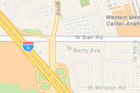
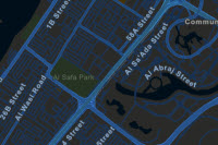
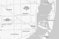
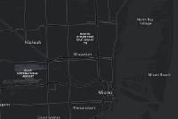
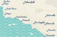
Basemaps
View unlisted / other basemaps here: Web Map Sources
-
 Imagery: Source Here
 -
 Imagery Hybrid: Source Here
 -
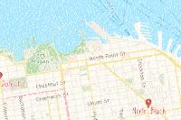
 Streets: Source Here
 -
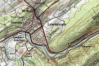
 Topographic: Source Here
 -
 Navigation: Source Here
 -
 Streets (Night): Source Here
 -
 Terrain with Labels: Source Here
 -
 Light Gray Canvas: Source Here
 -
 Dark Gray Canvas: Source Here
 -
 Oceans: Source Here
 -
 National Geographic Style Map: Source Here
 -
 OpenStreetMap: Source Here
 -
 Charted Territory Map: Source Here
 -
 Community Map: Source Here
 -
 Navigation (Dark Mode): Source Here
 -
 Newspaper Map: Source Here
 -
 Human Geography Map: Source Here
 -
 Human Geography Dark Map: Source Here
 -
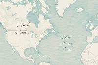 Modern Antique Map: Source Here
 -
 Mid-Century Map: Source Here
 -
 Nova Map: Source Here
 -
 Colored Pencil Map: Source Here
 -
 Watercolour Map: Source Here
 -
 USA Topo Maps: Source Here